Tour du lac de White Taker

PascalBanide
User
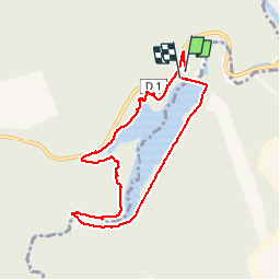

Length
7.2 km

Max alt
237 m

Uphill gradient
171 m
Km-Effort
9.4 km

Min alt
165 m

Downhill gradient
176 m
Boucle
Yes
Creation date :
2019-06-08 08:57:36.0
Updated on :
2019-06-08 11:33:42.171
2h22
Difficulty : Difficult

FREE GPS app for hiking
 SityTrail
IGN / Geographical institutes
SityTrail Plus
The world is yours!
About
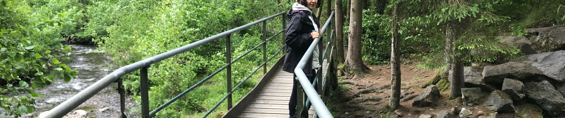
Trail Walking of 7.2 km to be discovered at Grand Est, Ardennes, Rocroi. This trail is proposed by PascalBanide.
Photos

Positioning
Country:
France
Region :
Grand Est
Department/Province :
Ardennes
Municipality :
Rocroi
Location:
Unknown
Start:(Dec)
Start:(UTM)
615498 ; 5531943 (31U) N.
Comments