


Gourbeyre le houelmont

sameja
User
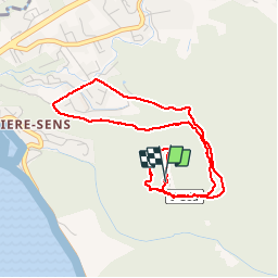

Length
6.3 km

Max alt
422 m

Uphill gradient
329 m
Km-Effort
10.7 km

Min alt
122 m

Downhill gradient
331 m
Boucle
Yes
Creation date :
2019-06-06 13:56:16.0
Updated on :
2019-06-09 06:29:16.106
1h49
Difficulty : Unknown

FREE GPS app for hiking
 SityTrail
IGN / Geographical institutes
SityTrail Plus
The world is yours!
About
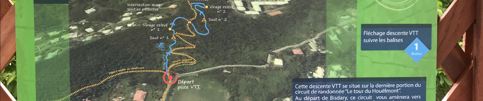
Trail Trail of 6.3 km to be discovered at Guadeloupe, Unknown, Gourbeyre. This trail is proposed by sameja.
Description
Observatoire volcanique
Photos

Positioning
Country:
France
Region :
Guadeloupe
Department/Province :
Unknown
Municipality :
Gourbeyre
Location:
Unknown
Start:(Dec)
Start:(UTM)
638686 ; 1767169 (20P) N.
Comments