


Puys_Goules_Pariou

jagarnier
User GUIDE
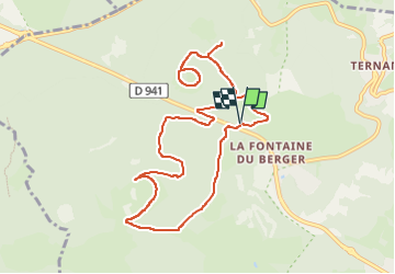

Length
10.6 km

Max alt
1179 m

Uphill gradient
407 m
Km-Effort
16.1 km

Min alt
966 m

Downhill gradient
406 m
Boucle
Yes
Creation date :
2019-06-09 07:05:50.395
Updated on :
2022-12-26 10:09:59.319
3h20
Difficulty : Medium

FREE GPS app for hiking
 SityTrail
IGN / Geographical institutes
SityTrail Plus
The world is yours!
About
Trail Walking of 10.6 km to be discovered at Auvergne-Rhône-Alpes, Puy-de-Dôme, Orcines. This trail is proposed by jagarnier.
Photos

Positioning
Country:
France
Region :
Auvergne-Rhône-Alpes
Department/Province :
Puy-de-Dôme
Municipality :
Orcines
Location:
Unknown
Start:(Dec)
Start:(UTM)
498990 ; 5072271 (31T) N.
Comments