


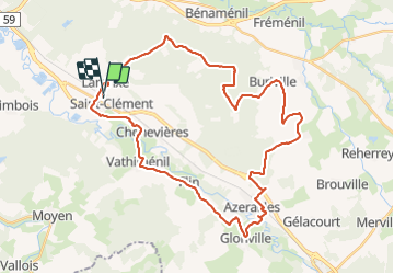
Sortie vtt 09062019 Buriville Hablainville Glonville

fabwin
User GUIDE


2h50
Difficulty : Medium

FREE GPS app for hiking
 SityTrail
IGN / Geographical institutes
SityTrail Plus
The world is yours!
About
Trail Mountain bike of 40 km to be discovered at Grand Est, Meurthe-et-Moselle, Saint-Clément. This trail is proposed by fabwin.
Description
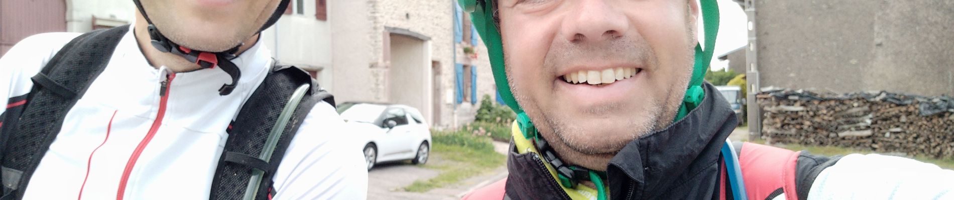
Belle sortie avec David, sous le soleil.
On a enfin pu passer aux habits d'été.
Un parcours sympathique et assez varié avec des beaux points de vue .
Une pointe à 56km/h toujours dans la même descente. Pourtant il me semblait que j'avais été plus vite!!!
Je valide définitivement mon choix d'être passé en plateau de 30 à l'avant. Je monte partout dorénavant et je trouve plus de souplesse dans mes relance.
Photos


Positioning
Comments