


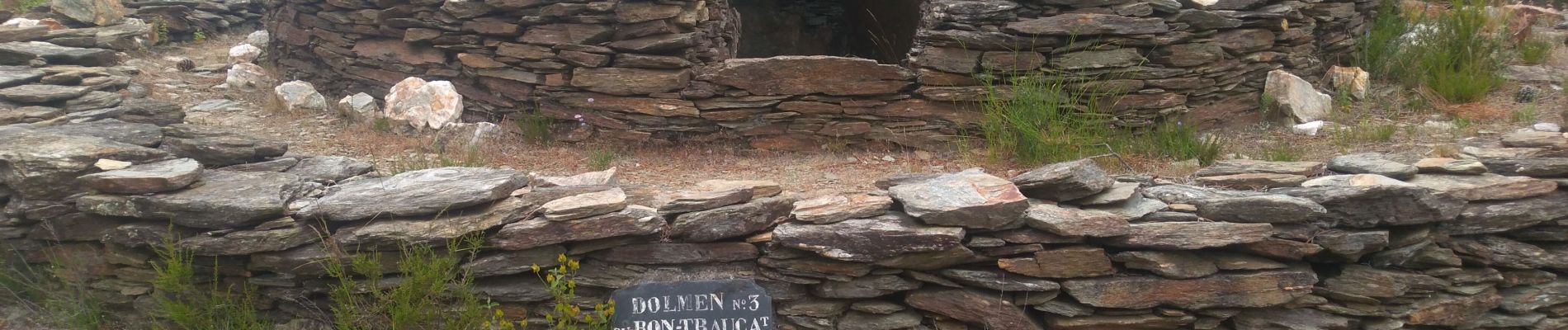
La Croix des vents

access
User
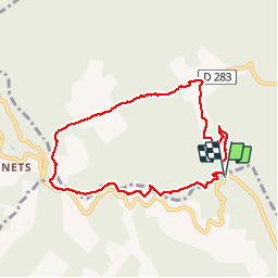

Length
8.2 km

Max alt
606 m

Uphill gradient
370 m
Km-Effort
13.2 km

Min alt
235 m

Downhill gradient
374 m
Boucle
Yes
Creation date :
2019-06-09 09:08:59.2
Updated on :
2019-06-09 12:09:53.576
2h30
Difficulty : Medium

FREE GPS app for hiking
 SityTrail
IGN / Geographical institutes
SityTrail Plus
The world is yours!
About
Trail Walking of 8.2 km to be discovered at Occitania, Gard, Soustelle. This trail is proposed by access.
Photos


Positioning
Country:
France
Region :
Occitania
Department/Province :
Gard
Municipality :
Soustelle
Location:
Unknown
Start:(Dec)
Start:(UTM)
580831 ; 4893239 (31T) N.
Comments