


Balade à Benodet

cess44
User

Length
11 km

Max alt
25 m

Uphill gradient
89 m
Km-Effort
12.2 km

Min alt
-1 m

Downhill gradient
87 m
Boucle
Yes
Creation date :
2014-12-10 00:00:00.0
Updated on :
2014-12-10 00:00:00.0
2h42
Difficulty : Easy

FREE GPS app for hiking
 SityTrail
IGN / Geographical institutes
SityTrail Plus
The world is yours!
About
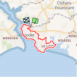
Trail Walking of 11 km to be discovered at Brittany, Finistère, Bénodet. This trail is proposed by cess44.
Positioning
Country:
France
Region :
Brittany
Department/Province :
Finistère
Municipality :
Bénodet
Location:
Unknown
Start:(Dec)
Start:(UTM)
417335 ; 5303596 (30T) N.
Comments