


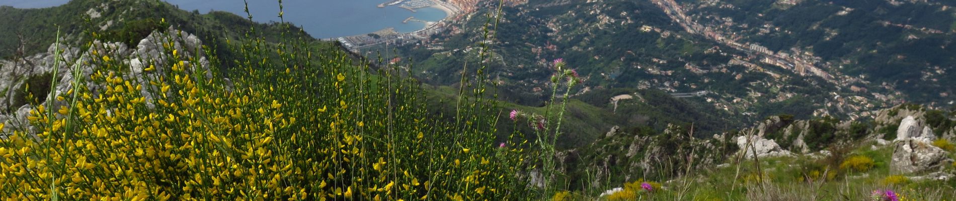
Cime de Restaud et Roc d'Orméa

Gouze13
User
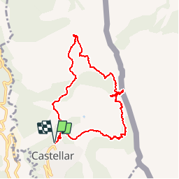

Length
9.1 km

Max alt
1128 m

Uphill gradient
799 m
Km-Effort
19.8 km

Min alt
339 m

Downhill gradient
799 m
Boucle
Yes
Creation date :
2019-06-11 06:21:59.881
Updated on :
2019-06-15 14:06:35.002
3h30
Difficulty : Easy
2h20
Difficulty : Difficult

FREE GPS app for hiking
 SityTrail
IGN / Geographical institutes
SityTrail Plus
The world is yours!
About
Trail Walking of 9.1 km to be discovered at Provence-Alpes-Côte d'Azur, Maritime Alps, Castellar. This trail is proposed by Gouze13.
Description
8/05/2019 - D 850 - Montée 1h10
Photos


Positioning
Country:
France
Region :
Provence-Alpes-Côte d'Azur
Department/Province :
Maritime Alps
Municipality :
Castellar
Location:
Unknown
Start:(Dec)
Start:(UTM)
379168 ; 4851467 (32T) N.
Comments