


Falaises du Blavet

aljac
User

Length
19.1 km

Max alt
301 m

Uphill gradient
513 m
Km-Effort
26 km

Min alt
38 m

Downhill gradient
495 m
Boucle
No
Creation date :
2019-06-11 12:16:47.748
Updated on :
2019-06-11 20:06:04.785
2h10
Difficulty : Medium

FREE GPS app for hiking
 SityTrail
IGN / Geographical institutes
SityTrail Plus
The world is yours!
About
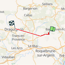
Trail Walking of 19.1 km to be discovered at Provence-Alpes-Côte d'Azur, Var, Bagnols-en-Forêt. This trail is proposed by aljac.
Positioning
Country:
France
Region :
Provence-Alpes-Côte d'Azur
Department/Province :
Var
Municipality :
Bagnols-en-Forêt
Location:
Unknown
Start:(Dec)
Start:(UTM)
310427 ; 4820804 (32T) N.
Comments