Trail Walking Montaigut-le-Blanc - Montaigut_Bal_Fees - Photo
 jagarnier
jagarnier

User GUIDE

© OpenStreetMap contributors
Length
Length
7.5 km
Max alt
Max alt
704 m
Uphill gradient
Uphill gradient
233 m
Km-Effort
Km-Effort  
10.6 km
Min alt
Min alt
483 m
Downhill gradient
Downhill gradient
232 m
Boucle
Boucle
Yes
Creation date :
2019-06-12 05:47:41.553
Updated on :
2023-08-12 06:39:52.89

(0 Reviews)

Walking
Walking
2h15
Difficulty : Easy

Scan this QR Code to open this trail in the SityTrail application

FREE GPS app for hiking

Logo SityTrail SityTrail

IGN / Geographical institutes

Download SityTrail from the App Store Download SityTrail from Google Play

Logo SityTrail SityTrail Plus

The world is yours!

Download SityTrail from the App Store Download SityTrail from Google Play Download SityTrail on Huawei AppGallery

About

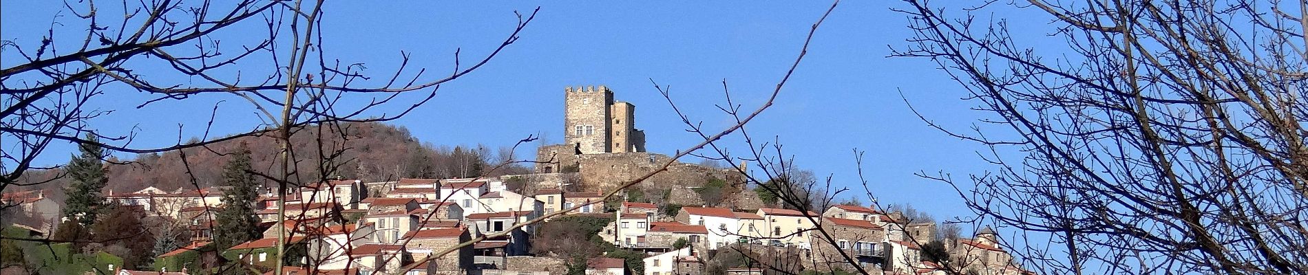
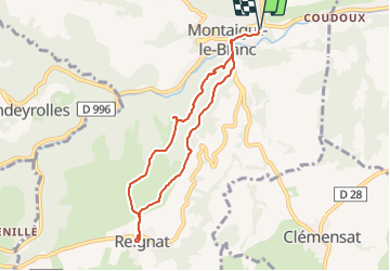
Trail Walking of 7.5 km to be discovered at Auvergne-Rhône-Alpes, Puy-de-Dôme, Montaigut-le-Blanc. This trail is proposed by jagarnier.

Description

Après une vive montée sous les chênes et les pins, vous atteindrez le plateau avec une très belle vue sur le donjon du château de Montaigut le Blanc. Ensuite, vous pourrez aller jusqu'à Reignat, ancien village vinicole, avant de revenir par un ravin frais où coule un moderte affluent de la Couze Chambon.

Elevation profile

Photos

Positioning

Country:
France
Region :
Auvergne-Rhône-Alpes
Department/Province :
Puy-de-Dôme
Municipality :
Montaigut-le-Blanc
Location:
Unknown
Start:(UTM)
507450 ; 5048092 (31T) N.


Close
My subscriptions