


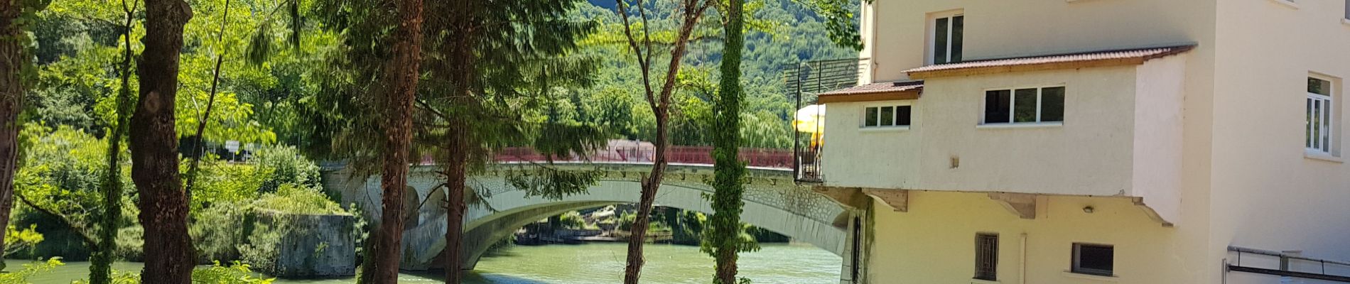
Pont de Poitte - Poncin

karawatsj
User
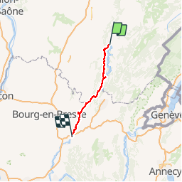

Length
76 km

Max alt
600 m

Uphill gradient
1002 m
Km-Effort
90 km

Min alt
259 m

Downhill gradient
1207 m
Boucle
No
Creation date :
2019-06-13 08:16:03.327
Updated on :
2019-06-13 14:59:38.582
4h42
Difficulty : Difficult

FREE GPS app for hiking
 SityTrail
IGN / Geographical institutes
SityTrail Plus
The world is yours!
About
Trail Bicycle tourism of 76 km to be discovered at Bourgogne-Franche-Comté, Jura, Pont-de-Poitte. This trail is proposed by karawatsj.
Description
Fantastische tocht langs de Ain. Mooie panorama's in een verlaten gebied.
Als fietsen door een paradijs.
Vele stuwen op de gedomesticeerde rivier.
Photos


Positioning
Country:
France
Region :
Bourgogne-Franche-Comté
Department/Province :
Jura
Municipality :
Pont-de-Poitte
Location:
Unknown
Start:(Dec)
Start:(UTM)
706413 ; 5161507 (31T) N.
Comments