


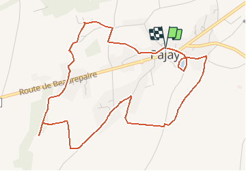
RS-Pajay-Truchaud

raymondfn
User

Length
6.3 km

Max alt
378 m

Uphill gradient
61 m
Km-Effort
7.1 km

Min alt
350 m

Downhill gradient
63 m
Boucle
Yes
Creation date :
2019-06-14 14:22:10.66
Updated on :
2021-01-29 14:03:02.099
1h28
Difficulty : Medium

FREE GPS app for hiking
 SityTrail
IGN / Geographical institutes
SityTrail Plus
The world is yours!
About
Trail Walking of 6.3 km to be discovered at Auvergne-Rhône-Alpes, Isère, Pajay. This trail is proposed by raymondfn.
Description
Rando santé, très légèrement vallonée, beaux panoramas.
Positioning
Country:
France
Region :
Auvergne-Rhône-Alpes
Department/Province :
Isère
Municipality :
Pajay
Location:
Unknown
Start:(Dec)
Start:(UTM)
667687 ; 5025670 (31T) N.
Comments