


Le Chatel ou Bonnet de Calvin

claude nier
User

Length
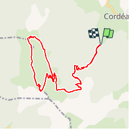
12.2 km

Max alt
1932 m

Uphill gradient
944 m
Km-Effort
25 km

Min alt
1016 m

Downhill gradient
943 m
Boucle
Yes
Creation date :
2019-06-15 11:54:09.973
Updated on :
2019-06-15 11:55:15.92
4h54
Difficulty : Very difficult

FREE GPS app for hiking
 SityTrail
IGN / Geographical institutes
SityTrail Plus
The world is yours!
About
Trail Walking of 12.2 km to be discovered at Auvergne-Rhône-Alpes, Isère, Châtel-en-Trièves. This trail is proposed by claude nier.
Description
belle rando et beau spectacle...a faire absolument
Positioning
Country:
France
Region :
Auvergne-Rhône-Alpes
Department/Province :
Isère
Municipality :
Châtel-en-Trièves
Location:
Cordéac
Start:(Dec)
Start:(UTM)
724100 ; 4966934 (31T) N.
Comments