


CC_Velay_CA_10_Conques-Rouergue_Livinhac-Haut_20071101

patrickdanilo
User
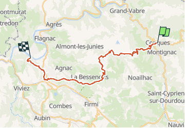

Length
26 km

Max alt
583 m

Uphill gradient
876 m
Km-Effort
38 km

Min alt
193 m

Downhill gradient
956 m
Boucle
No
Creation date :
2019-06-16 18:18:04.206
Updated on :
2022-09-15 15:21:53.692
7h00
Difficulty : Difficult

FREE GPS app for hiking
 SityTrail
IGN / Geographical institutes
SityTrail Plus
The world is yours!
About
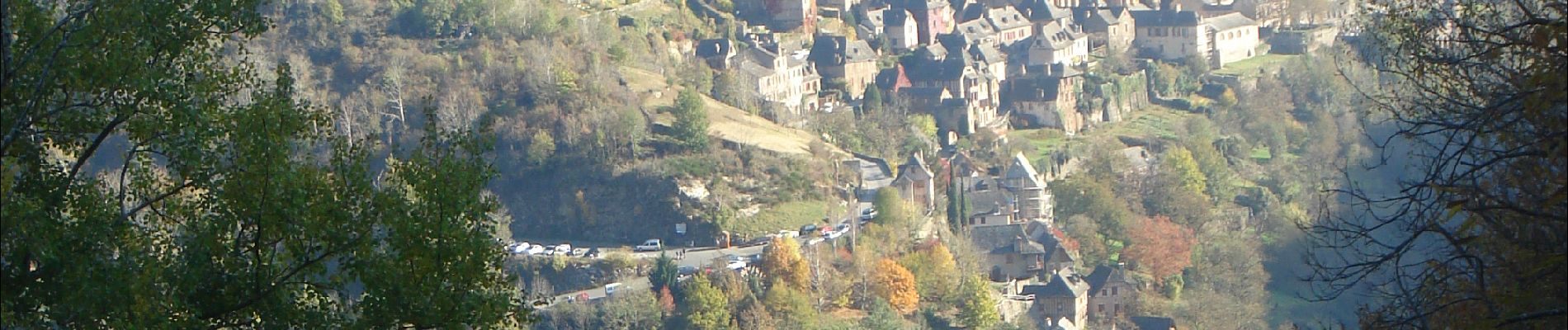
Trail Walking of 26 km to be discovered at Occitania, Aveyron, Conques-en-Rouergue. This trail is proposed by patrickdanilo.
Description
Randonnée Marche de 26 km à découvrir à Occitanie, Aveyron, Conques-en-Rouergue. Cette randonnée est proposée par patrickdanilo.
Photos


Positioning
Country:
France
Region :
Occitania
Department/Province :
Aveyron
Municipality :
Conques-en-Rouergue
Location:
Unknown
Start:(Dec)
Start:(UTM)
452156 ; 4938594 (31T) N.
Comments