


Lac du Goléon (17-06-19)

Thomasdanielle
User

Length
11.9 km

Max alt
2515 m

Uphill gradient
793 m
Km-Effort
23 km

Min alt
1747 m

Downhill gradient
793 m
Boucle
Yes
Creation date :
2019-06-17 06:53:52.0
Updated on :
2019-06-25 14:24:45.286
5h55
Difficulty : Very difficult

FREE GPS app for hiking
 SityTrail
IGN / Geographical institutes
SityTrail Plus
The world is yours!
About
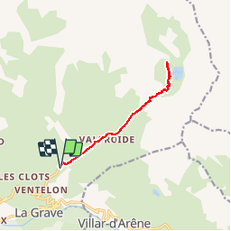
Trail Walking of 11.9 km to be discovered at Provence-Alpes-Côte d'Azur, Hautes-Alpes, La Grave. This trail is proposed by Thomasdanielle.
Description
D/A A pieds depuis les Hières (12 km - D793 m)
Randonnée très difficile - A cette période le lac est gelé.
Positioning
Country:
France
Region :
Provence-Alpes-Côte d'Azur
Department/Province :
Hautes-Alpes
Municipality :
La Grave
Location:
Unknown
Start:(Dec)
Start:(UTM)
288620 ; 4992828 (32T) N.
Comments