


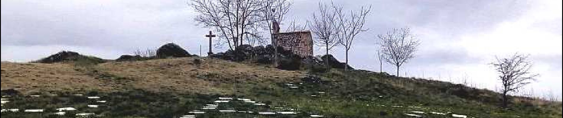
St_Babel_Tailleur_Pierres

jagarnier
User GUIDE
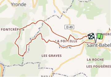

Length
10.5 km

Max alt
676 m

Uphill gradient
291 m
Km-Effort
14.3 km

Min alt
521 m

Downhill gradient
289 m
Boucle
Yes
Creation date :
2019-06-18 05:24:23.797
Updated on :
2022-08-26 07:20:08.563
3h00
Difficulty : Medium

FREE GPS app for hiking
 SityTrail
IGN / Geographical institutes
SityTrail Plus
The world is yours!
About
Trail Walking of 10.5 km to be discovered at Auvergne-Rhône-Alpes, Puy-de-Dôme, Saint-Babel. This trail is proposed by jagarnier.
Photos

Positioning
Country:
France
Region :
Auvergne-Rhône-Alpes
Department/Province :
Puy-de-Dôme
Municipality :
Saint-Babel
Location:
Unknown
Start:(Dec)
Start:(UTM)
523279 ; 5049432 (31T) N.
Comments