roc la tour f

grmb
User
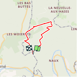

Length
9.4 km

Max alt
473 m

Uphill gradient
178 m
Km-Effort
11.7 km

Min alt
387 m

Downhill gradient
176 m
Boucle
Yes
Creation date :
2019-06-13 11:40:24.699
Updated on :
2019-06-18 15:12:50.578
2h26
Difficulty : Very easy

FREE GPS app for hiking
 SityTrail
IGN / Geographical institutes
SityTrail Plus
The world is yours!
About
Trail Walking of 9.4 km to be discovered at Grand Est, Ardennes, Monthermé. This trail is proposed by grmb.
Description
Fep
Roc la tour
Positioning
Country:
France
Region :
Grand Est
Department/Province :
Ardennes
Municipality :
Monthermé
Location:
Unknown
Start:(Dec)
Start:(UTM)
628035 ; 5528214 (31U) N.
Comments