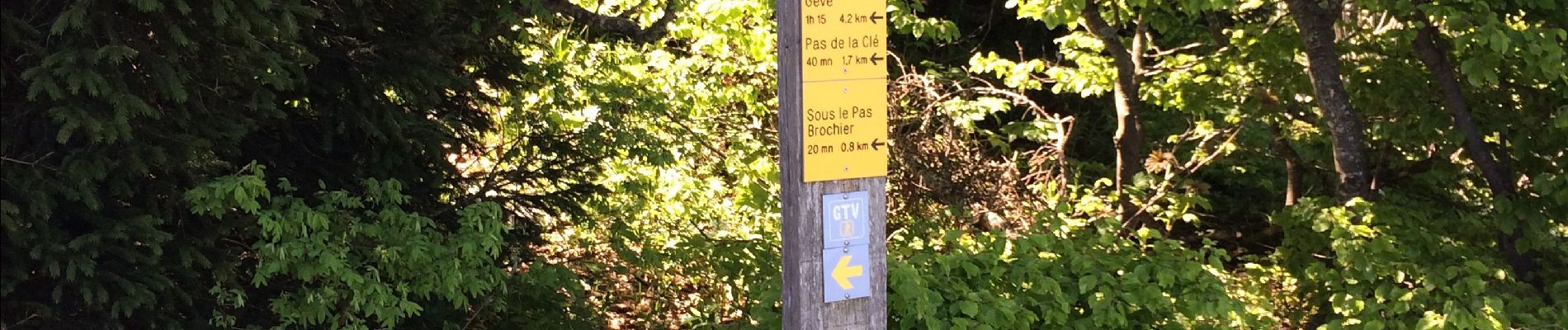
Trail Walking Montaud - Pas Brochier  - Photo
 ajd26
ajd26

User

© OpenStreetMap contributors
Length
Length
11.5 km
Max alt
Max alt
1634 m
Uphill gradient
Uphill gradient
1167 m
Km-Effort
Km-Effort  
27 km
Min alt
Min alt
1138 m
Downhill gradient
Downhill gradient
1168 m
Boucle
Boucle
Yes
Creation date :
2019-06-13 07:32:16.0
Updated on :
2019-06-28 09:56:36.306

(0 Reviews)

Walking
Walking
6h00
Difficulty : Very difficult

Scan this QR Code to open this trail in the SityTrail application

FREE GPS app for hiking

Logo SityTrail SityTrail

IGN / Geographical institutes

Download SityTrail from the App Store Download SityTrail from Google Play

Logo SityTrail SityTrail Plus

The world is yours!

Download SityTrail from the App Store Download SityTrail from Google Play Download SityTrail on Huawei AppGallery

About

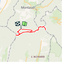
Trail Walking of 11.5 km to be discovered at Auvergne-Rhône-Alpes, Isère, Montaud. This trail is proposed by ajd26.

Description

Depuis Montaud sur la route du tunnel, pas Brochier très difficile il faut grimper avec les mains, Bec de l’Orient, la grande Brèche, la Buffe et retour par le pas de la  Clé très joli rando à faire par temps sec impérativement  12 km

Elevation profile

Photos

Positioning

Country:
France
Region :
Auvergne-Rhône-Alpes
Department/Province :
Isère
Municipality :
Montaud
Location:
Unknown
Start:(UTM)
700287 ; 5012912 (31T) N.


Close
My subscriptions