


CC_Velay_EB_18_Moissac_St-Antoine_20080818

patrickdanilo
User
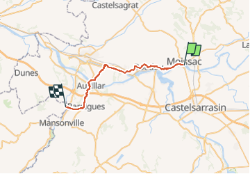

Length
30 km

Max alt
185 m

Uphill gradient
576 m
Km-Effort
38 km

Min alt
55 m

Downhill gradient
583 m
Boucle
No
Creation date :
2019-06-19 12:24:52.943
Updated on :
2022-09-17 13:36:20.89
8h35
Difficulty : Easy

FREE GPS app for hiking
 SityTrail
IGN / Geographical institutes
SityTrail Plus
The world is yours!
About
Trail Walking of 30 km to be discovered at Occitania, Tarn-et-Garonne, Moissac. This trail is proposed by patrickdanilo.
Description
Randonnée Marche de 30 km à découvrir à Occitanie, Tarn-et-Garonne, Moissac. Cette randonnée est proposée par patrickdanilo.
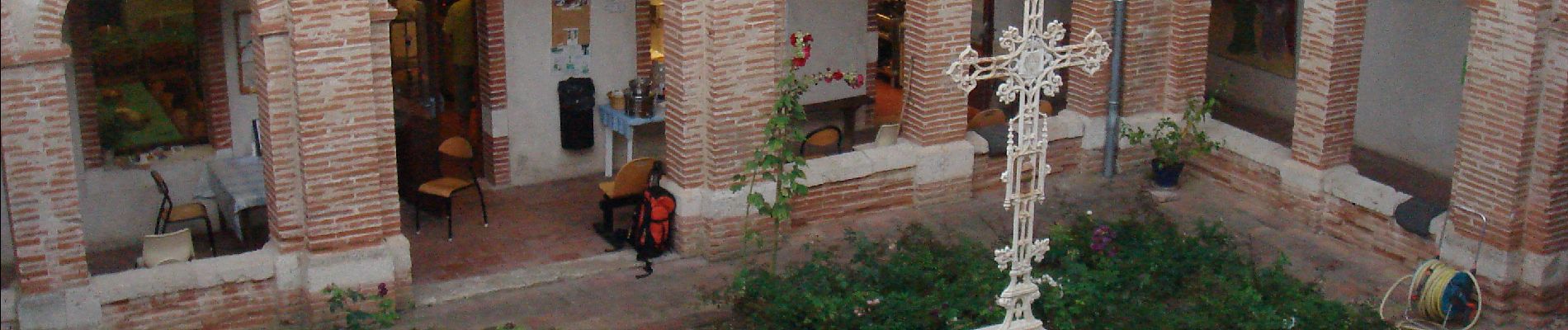
Photos


Positioning
Country:
France
Region :
Occitania
Department/Province :
Tarn-et-Garonne
Municipality :
Moissac
Location:
Unknown
Start:(Dec)
Start:(UTM)
346710 ; 4884747 (31T) N.
Comments