


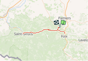
loubens foix st girons fois

Maca8284
User

Length
103 km

Max alt
526 m

Uphill gradient
1462 m
Km-Effort
122 km

Min alt
365 m

Downhill gradient
1462 m
Boucle
Yes
Creation date :
2014-12-10 00:00:00.0
Updated on :
2014-12-10 00:00:00.0
7h43
Difficulty : Difficult

FREE GPS app for hiking
 SityTrail
IGN / Geographical institutes
SityTrail Plus
The world is yours!
About
Trail Cycle of 103 km to be discovered at Occitania, Ariège, Loubens. This trail is proposed by Maca8284.
Description
longue
Positioning
Country:
France
Region :
Occitania
Department/Province :
Ariège
Municipality :
Loubens
Location:
Unknown
Start:(Dec)
Start:(UTM)
382348 ; 4765327 (31T) N.
Comments