


GR20 - J1

uru2010
User

Length
19.2 km

Max alt
1201 m

Uphill gradient
1545 m
Km-Effort
37 km

Min alt
225 m

Downhill gradient
579 m
Boucle
No
Creation date :
2019-06-17 05:31:25.109
Updated on :
2019-06-21 16:15:46.631
12h15
Difficulty : Very difficult

FREE GPS app for hiking
 SityTrail
IGN / Geographical institutes
SityTrail Plus
The world is yours!
About
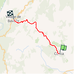
Trail Trail of 19.2 km to be discovered at Corsica, South Corsica, Conca. This trail is proposed by uru2010.
Positioning
Country:
France
Region :
Corsica
Department/Province :
South Corsica
Municipality :
Conca
Location:
Unknown
Start:(Dec)
Start:(UTM)
528037 ; 4620217 (32T) N.
Comments