Trail Bicycle tourism Sète - Sète -Narbonne - Photo

Sète -Narbonne

© OpenStreetMap contributors
Length
Length
76 km
Max alt
Max alt
48 m
Uphill gradient
Uphill gradient
444 m
Km-Effort
Km-Effort  
82 km
Min alt
Min alt
-6 m
Downhill gradient
Downhill gradient
441 m
Boucle
Boucle
No
Creation date :
2019-06-22 07:37:44.36
Updated on :
2019-06-22 21:35:19.37

(0 Reviews)

Bicycle tourism
Bicycle tourism
5h03
Difficulty : Difficult

Scan this QR Code to open this trail in the SityTrail application

FREE GPS app for hiking

Logo SityTrail SityTrail

IGN / Geographical institutes

Download SityTrail from the App Store Download SityTrail from Google Play

Logo SityTrail SityTrail World

The world is yours!

Download SityTrail from the App Store Download SityTrail from Google Play Download SityTrail on Huawei AppGallery

About

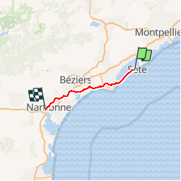
Trail Bicycle tourism of 76 km to be discovered at Occitania, Hérault, Sète. This trail is proposed by karawatsj.

Description

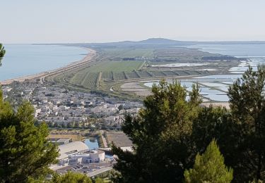
Door de vlakte van de Hérault, de Orb en de Aude.

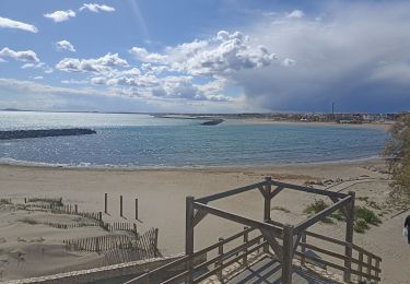
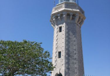
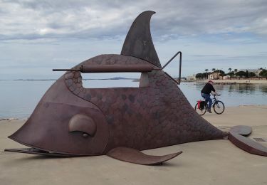
We verlaten de badstad Séte over een mooi fietspad door de smalle duinengordel tussen de Middellandse Zee en het Etang de Thau.

In Marseillan Plage sluiten we aan op het Canal du Midi.  Dat kanaal verlaten we slechts even te Agden om een fietsenmaker te zoeken.

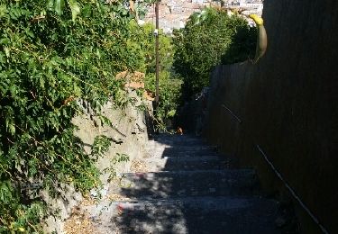
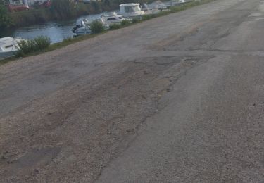
De weg langs de Canal du Midi is onverhard en in slechte staat, eigenlijk uitsluitend voor VTT geschikt.

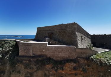
De historische "Ouvrages du Libron" en de aangename stopplaats (bar en resto) aan de jachthaven van Le Boat zijn om niet te missen.

We verlate he Canal du Midi en steken even latet de Orb over en komen al snel op het  gezellige marktplein te Sérignan terecht.

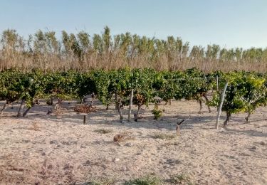
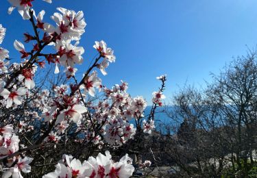
We klimmen uit de vallei van de Orb naar de wijngaarden op het plateau en dalen weer af in de vallei van de Aude die we even volgen maar dan oversteken.

Door de vlakte, vol met wijngaarden, en ver weg in het zuiden de Pyreneeën en in het Westen de bergen van Haut Languedoc fietsen we (over slechte wegen) tot de oude stad Narbonne met dwars door de stad het Canal de la Robine.

Zeer afwisselend, mooi, maar zwaar.

Elevation profile

Photos

Positioning

Country:
France
Region :
Occitania
Department/Province :
Hérault
Municipality :
Sète
Location:
Unknown
Start:(UTM)
554560 ; 4804659 (31T) N.

Trails nearby

Trail Walking Sète - Jolie balade à Sète  - Photo
Walking
jeff2

Walking

Easy
Sète, Occitania, Hérault, France
12.8 km | 14.6 km-effort
7h 8min
Yes
Trail Mountain bike Sète - listel - Photo
Mountain bike
dthamie@wanadoo.fr

Mountain bike

Very easy
Sète, Occitania, Hérault, France
8.7 km | 9.1 km-effort
54min
No
Trail Nordic walking Sète - 34-Sète Mt St Clair Corniche Centre ville - Photo
Nordic walking
Maryma

Nordic walking

Very easy
Sète, Occitania, Hérault, France
10.4 km | 14.3 km-effort
2h 36min
Yes
Trail Walking Sète - CAP D'AGDE ( Sète et le Mont St- Clair) - Photo
Walking
GerardBouche

Walking

Medium
Sète, Occitania, Hérault, France
7.1 km | 9.8 km-effort
2h 4min
Yes
Trail Walking Sète - Mont St. Clair, Sète.  - Photo
Walking
Daniel.BRUN-PICARD

Walking

Easy
Sète, Occitania, Hérault, France
6.8 km | 9.6 km-effort
4h 10min
Yes
Trail Walking Sète - Sète  - Photo
Walking
GUIDE
Roger Philippe Wallez

Walking

Difficult
Sète, Occitania, Hérault, France
12.6 km | 17.1 km-effort
4h 58min
Yes
Trail Road bike Sète - vélo sete balaruc pinet - Photo
Road bike
himba26100

Road bike

Medium
Sète, Occitania, Hérault, France
67 km | 73 km-effort
6h 20min
Yes
Trail Hybrid bike Balaruc-les-Bains - Balaruc ➡️ Meze - Photo
Hybrid bike
sereton

Hybrid bike

Easy
Balaruc-les-Bains, Occitania, Hérault, France
32 km | 35 km-effort
2h 4min
Yes
Trail Hybrid bike Sète - Ballade autour du Mont Saint-Clair - Photo
Hybrid bike
eric004

Hybrid bike

Medium
Sète, Occitania, Hérault, France
15.6 km | 18.5 km-effort
1h 15min
Yes


Close
My subscriptions