


Forêt communale de Bouilly

FPortier
User
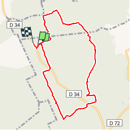

Length
8.5 km

Max alt
304 m

Uphill gradient
134 m
Km-Effort
10.3 km

Min alt
232 m

Downhill gradient
139 m
Boucle
Yes
Creation date :
2019-06-20 12:06:05.533
Updated on :
2019-06-23 12:29:14.507
2h41
Difficulty : Very easy

FREE GPS app for hiking
 SityTrail
IGN / Geographical institutes
SityTrail Plus
The world is yours!
About
Trail Walking of 8.5 km to be discovered at Grand Est, Aube, Bouilly. This trail is proposed by FPortier.
Description
rando club 20 juin 2919
Positioning
Country:
France
Region :
Grand Est
Department/Province :
Aube
Municipality :
Bouilly
Location:
Unknown
Start:(Dec)
Start:(UTM)
570925 ; 5337893 (31U) N.
Comments