


Tour ouest de la presqu'île de Giens

Daniel.BRUN-PICARD
User
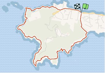

Length
6.7 km

Max alt
93 m

Uphill gradient
245 m
Km-Effort
9.9 km

Min alt
0 m

Downhill gradient
242 m
Boucle
Yes
Creation date :
2019-06-23 08:44:39.011
Updated on :
2021-01-05 08:39:17.553
3h00
Difficulty : Medium

FREE GPS app for hiking
 SityTrail
IGN / Geographical institutes
SityTrail Plus
The world is yours!
About
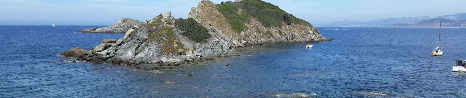
Trail Walking of 6.7 km to be discovered at Provence-Alpes-Côte d'Azur, Var, Hyères. This trail is proposed by Daniel.BRUN-PICARD.
Photos


Positioning
Country:
France
Region :
Provence-Alpes-Côte d'Azur
Department/Province :
Var
Municipality :
Hyères
Location:
Unknown
Start:(Dec)
Start:(UTM)
264614 ; 4769251 (32T) N.
Comments