


Ceillac j1

MartinBraudThierry
User
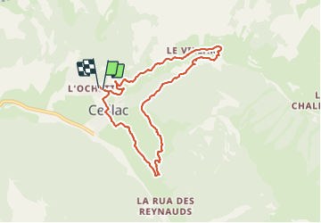

Length
8.1 km

Max alt
1864 m

Uphill gradient
303 m
Km-Effort
12.2 km

Min alt
1637 m

Downhill gradient
295 m
Boucle
Yes
Creation date :
2019-06-23 10:37:43.019
Updated on :
2019-06-23 13:52:25.943
3h13
Difficulty : Easy

FREE GPS app for hiking
 SityTrail
IGN / Geographical institutes
SityTrail Plus
The world is yours!
About
Trail Walking of 8.1 km to be discovered at Provence-Alpes-Côte d'Azur, Hautes-Alpes, Ceillac. This trail is proposed by MartinBraudThierry.
Photos


Positioning
Country:
France
Region :
Provence-Alpes-Côte d'Azur
Department/Province :
Hautes-Alpes
Municipality :
Ceillac
Location:
Unknown
Start:(Dec)
Start:(UTM)
323796 ; 4948825 (32T) N.
Comments