Cantal - Albepierre - les Cascades - 9.6km 330m 3h25 - 2019 06 23

Orcal37
User GUIDE
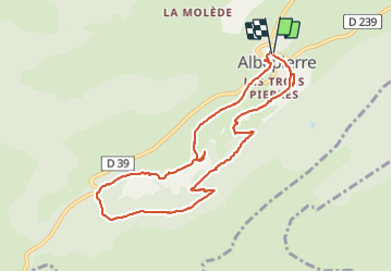

Length
9.6 km

Max alt
1343 m

Uphill gradient
336 m
Km-Effort
14.1 km

Min alt
1032 m

Downhill gradient
337 m
Boucle
Yes
Creation date :
2019-06-23 12:22:52.854
Updated on :
2021-09-11 13:55:26.505
3h26
Difficulty : Easy

FREE GPS app for hiking
 SityTrail
IGN / Geographical institutes
SityTrail Plus
The world is yours!
About
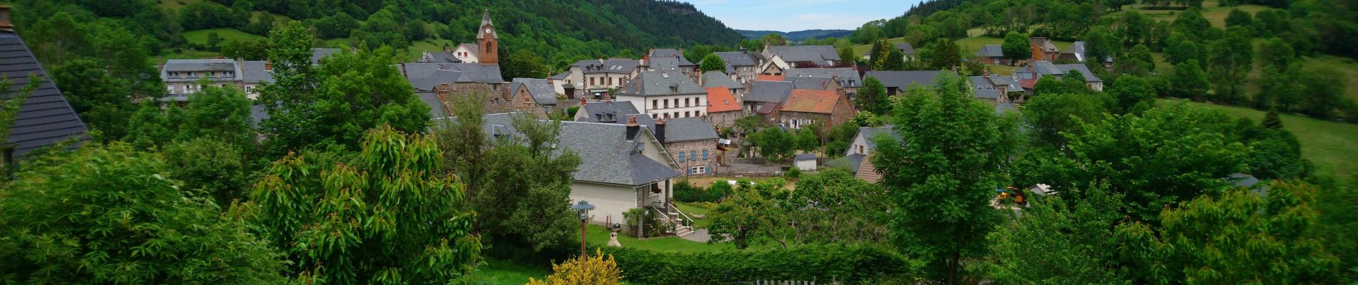
Trail Walking of 9.6 km to be discovered at Auvergne-Rhône-Alpes, Cantal, Albepierre-Bredons. This trail is proposed by Orcal37.
Description
Cantal - Albepierre - les Cascades - 9.6km 330m 3h25 - 2019 06 23
Photos


Positioning
Country:
France
Region :
Auvergne-Rhône-Alpes
Department/Province :
Cantal
Municipality :
Albepierre-Bredons
Location:
Unknown
Start:(Dec)
Start:(UTM)
486851 ; 4991556 (31T) N.
Comments