


RS-SSDB-Beauregard

raymondfn
User
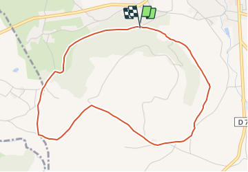

Length
5 km

Max alt
474 m

Uphill gradient
75 m
Km-Effort
6 km

Min alt
418 m

Downhill gradient
71 m
Boucle
Yes
Creation date :
2019-06-25 13:01:07.697
Updated on :
2022-01-31 10:59:48.525
1h19
Difficulty : Easy

FREE GPS app for hiking
 SityTrail
IGN / Geographical institutes
SityTrail Plus
The world is yours!
About
Trail Walking of 5 km to be discovered at Auvergne-Rhône-Alpes, Isère, Saint-Siméon-de-Bressieux. This trail is proposed by raymondfn.
Positioning
Country:
France
Region :
Auvergne-Rhône-Alpes
Department/Province :
Isère
Municipality :
Saint-Siméon-de-Bressieux
Location:
Unknown
Start:(Dec)
Start:(UTM)
676669 ; 5021453 (31T) N.
Comments