


05 - NÉVACHE

AndreLACOMBE
User

Length
4.8 km

Max alt
2503 m

Uphill gradient
489 m
Km-Effort
11.3 km

Min alt
2021 m

Downhill gradient
484 m
Boucle
Yes
Creation date :
2019-06-26 07:54:46.374
Updated on :
2019-06-26 14:10:49.659
5h15
Difficulty : Medium

FREE GPS app for hiking
 SityTrail
IGN / Geographical institutes
SityTrail Plus
The world is yours!
About
Trail Walking of 4.8 km to be discovered at Provence-Alpes-Côte d'Azur, Hautes-Alpes, Névache. This trail is proposed by AndreLACOMBE.
Description
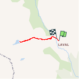
Depuis les chalets de Laval, montée au lac des Béraudes et retour.
Positioning
Country:
France
Region :
Provence-Alpes-Côte d'Azur
Department/Province :
Hautes-Alpes
Municipality :
Névache
Location:
Unknown
Start:(Dec)
Start:(UTM)
305204 ; 4992498 (32T) N.
Comments