


Circuit du pantgat

denissculier
User

Length
6.5 km

Max alt
52 m

Uphill gradient
51 m
Km-Effort
7.2 km

Min alt
14 m

Downhill gradient
50 m
Boucle
Yes
Creation date :
2019-06-27 12:27:38.424
Updated on :
2019-06-27 12:39:26.747
1h35
Difficulty : Easy

FREE GPS app for hiking
 SityTrail
IGN / Geographical institutes
SityTrail Plus
The world is yours!
About
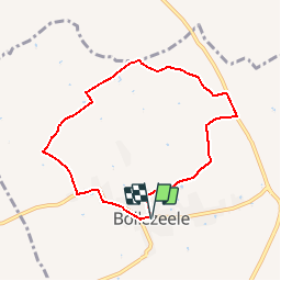
Trail Nordic walking of 6.5 km to be discovered at Hauts-de-France, Nord, Bollezeele. This trail is proposed by denissculier.
Description
Circuit à cheval sur l'ancien talus maritime, entre la plaine littorale et le "Houtland" (pays au bois) flamand, sans difficultés particulières
Positioning
Country:
France
Region :
Hauts-de-France
Department/Province :
Nord
Municipality :
Bollezeele
Location:
Unknown
Start:(Dec)
Start:(UTM)
452680 ; 5635096 (31U) N.
Comments