


RS-Viriville-BrinDamour

raymondfn
User
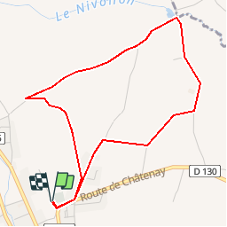

Length
4.8 km

Max alt
374 m

Uphill gradient
59 m
Km-Effort
5.6 km

Min alt
321 m

Downhill gradient
60 m
Boucle
Yes
Creation date :
2019-06-28 13:00:03.913
Updated on :
2019-08-23 14:30:11.145
1h13
Difficulty : Easy

FREE GPS app for hiking
 SityTrail
IGN / Geographical institutes
SityTrail Plus
The world is yours!
About
Trail Walking of 4.8 km to be discovered at Auvergne-Rhône-Alpes, Isère, Viriville. This trail is proposed by raymondfn.
Positioning
Country:
France
Region :
Auvergne-Rhône-Alpes
Department/Province :
Isère
Municipality :
Viriville
Location:
Unknown
Start:(Dec)
Start:(UTM)
672799 ; 5020941 (31T) N.
Comments