Trail Walking Gavarnie-Gèdre - pic de Lary thmie fait - Photo
 LouisROGER
LouisROGER

User GUIDE

© OpenStreetMap contributors
Length
Length
7.9 km
Max alt
Max alt
2374 m
Uphill gradient
Uphill gradient
654 m
Km-Effort
Km-Effort  
16.6 km
Min alt
Min alt
1716 m
Downhill gradient
Downhill gradient
659 m
Boucle
Boucle
Yes
Creation date :
2019-06-28 07:15:15.716
Updated on :
2019-06-29 12:18:54.536

(0 Reviews)

Walking
Walking
6h42
Difficulty : Medium

Scan this QR Code to open this trail in the SityTrail application

FREE GPS app for hiking

Logo SityTrail SityTrail

IGN / Geographical institutes

Download SityTrail from the App Store Download SityTrail from Google Play

Logo SityTrail SityTrail Plus

The world is yours!

Download SityTrail from the App Store Download SityTrail from Google Play Download SityTrail on Huawei AppGallery

About

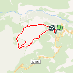
Trail Walking of 7.9 km to be discovered at Occitania, Hautespyrenees, Gavarnie-Gèdre. This trail is proposed by LouisROGER.

Description

montée raide sans obstacles au milieu des troupeaux et marmottes
Très beau panorama depuis le pic,
retour avec rhododendrons  et futurs églantiers et framboisiers au niveau du poey Arrabi descendre au plus court vers le sentier.

Elevation profile

Photos

Positioning

Country:
France
Region :
Occitania
Department/Province :
Hautespyrenees
Municipality :
Gavarnie-Gèdre
Location:
Gavarnie
Start:(UTM)
743063 ; 4735910 (30T) N.


Close
My subscriptions