


Cantal - Cheyrouze (Laveissière) - Puy de Seycheuse - 14.8km 600m 5h35 - 2019 06 30

Orcal37
User GUIDE
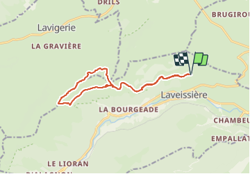

Length
14.8 km

Max alt
1632 m

Uphill gradient
593 m
Km-Effort
23 km

Min alt
1125 m

Downhill gradient
594 m
Boucle
Yes
Creation date :
2019-06-30 05:59:54.254
Updated on :
2021-09-11 13:21:51.027
5h35
Difficulty : Medium

FREE GPS app for hiking
 SityTrail
IGN / Geographical institutes
SityTrail Plus
The world is yours!
About
Trail Walking of 14.8 km to be discovered at Auvergne-Rhône-Alpes, Cantal, Laveissière. This trail is proposed by Orcal37.
Description
Cantal - Cheyrouze (Laveissière) - le Puy de Seycheuse - 14.8km 600m 5h35 - 2019 06 30
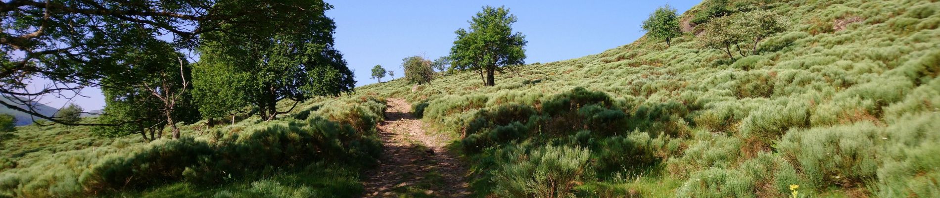
Photos
 - Puy de Seycheuse - 14.8km 600m 5h35 - 2019 06 30 - Photo 1")
 - Puy de Seycheuse - 14.8km 600m 5h35 - 2019 06 30 - Photo 2")
 - Puy de Seycheuse - 14.8km 600m 5h35 - 2019 06 30 - Photo 3")
 - Puy de Seycheuse - 14.8km 600m 5h35 - 2019 06 30 - Photo 4")
 - Puy de Seycheuse - 14.8km 600m 5h35 - 2019 06 30 - Photo 5")
 - Puy de Seycheuse - 14.8km 600m 5h35 - 2019 06 30 - Photo 6")
 - Puy de Seycheuse - 14.8km 600m 5h35 - 2019 06 30 - Photo 7")
Positioning
Country:
France
Region :
Auvergne-Rhône-Alpes
Department/Province :
Cantal
Municipality :
Laveissière
Location:
Unknown
Start:(Dec)
Start:(UTM)
485181 ; 4996539 (31T) N.
Comments