


Cantal - Molompize - Aurouze et Suc de Védrines - 17.7km 770m 7h05 - 2019 07 02

Orcal37
User GUIDE
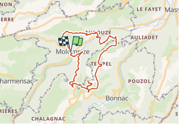

Length
17.7 km

Max alt
989 m

Uphill gradient
767 m
Km-Effort
28 km

Min alt
570 m

Downhill gradient
770 m
Boucle
Yes
Creation date :
2019-07-02 06:37:34.684
Updated on :
2021-09-11 13:14:23.308
7h00
Difficulty : Medium

FREE GPS app for hiking
 SityTrail
IGN / Geographical institutes
SityTrail Plus
The world is yours!
About
Trail Walking of 17.7 km to be discovered at Auvergne-Rhône-Alpes, Cantal, Molompize. This trail is proposed by Orcal37.
Description
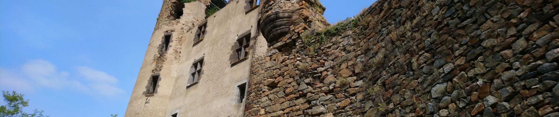
Cantal - Molompize - le Suc de Védrines via le château d'Aurouze - 17.7km 770m 7h05 - 2019 07 02
Photos


Positioning
Country:
France
Region :
Auvergne-Rhône-Alpes
Department/Province :
Cantal
Municipality :
Molompize
Location:
Unknown
Start:(Dec)
Start:(UTM)
509887 ; 5008565 (31T) N.
Comments