


la bombardelle

clozelmarie
User

Length
10.1 km

Max alt
1623 m

Uphill gradient
581 m
Km-Effort
19.4 km

Min alt
928 m

Downhill gradient
1039 m
Boucle
No
Creation date :
2019-07-03 09:38:20.745
Updated on :
2019-07-03 14:02:38.727
1h26
Difficulty : Very easy

FREE GPS app for hiking
 SityTrail
IGN / Geographical institutes
SityTrail Plus
The world is yours!
About
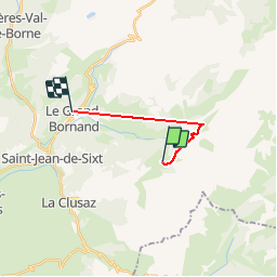
Trail Walking of 10.1 km to be discovered at Auvergne-Rhône-Alpes, Upper Savoy, La Clusaz. This trail is proposed by clozelmarie.
Positioning
Country:
France
Region :
Auvergne-Rhône-Alpes
Department/Province :
Upper Savoy
Municipality :
La Clusaz
Location:
Unknown
Start:(Dec)
Start:(UTM)
304892 ; 5088528 (32T) N.
Comments