


2019-07-04 Sommet Bucher

Bernardb44
User
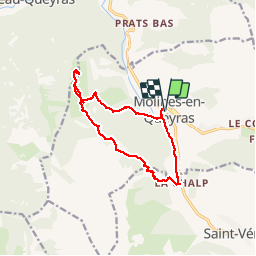

Length
13.2 km

Max alt
2254 m

Uphill gradient
688 m
Km-Effort
22 km

Min alt
1710 m

Downhill gradient
688 m
Boucle
Yes
Creation date :
2019-07-04 06:27:24.158
Updated on :
2019-07-04 12:26:14.873
5h57
Difficulty : Medium

FREE GPS app for hiking
 SityTrail
IGN / Geographical institutes
SityTrail Plus
The world is yours!
About
Trail Walking of 13.2 km to be discovered at Provence-Alpes-Côte d'Azur, Hautes-Alpes, Molines-en-Queyras. This trail is proposed by Bernardb44.
Positioning
Country:
France
Region :
Provence-Alpes-Côte d'Azur
Department/Province :
Hautes-Alpes
Municipality :
Molines-en-Queyras
Location:
Unknown
Start:(Dec)
Start:(UTM)
329230 ; 4955113 (32T) N.
Comments