


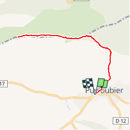
Ste Victoire: Puyloubier - Pic des Mouches

phidge
User

Length
8.8 km

Max alt
998 m

Uphill gradient
663 m
Km-Effort
17.6 km

Min alt
344 m

Downhill gradient
664 m
Boucle
Yes
Creation date :
2019-07-04 16:03:34.727
Updated on :
2019-07-04 16:08:09.917
2h29
Difficulty : Medium

FREE GPS app for hiking
 SityTrail
IGN / Geographical institutes
SityTrail Plus
The world is yours!
About
Trail Walking of 8.8 km to be discovered at Provence-Alpes-Côte d'Azur, Bouches-du-Rhône, Puyloubier. This trail is proposed by phidge.
Description
P2 T2
Positioning
Country:
France
Region :
Provence-Alpes-Côte d'Azur
Department/Province :
Bouches-du-Rhône
Municipality :
Puyloubier
Location:
Unknown
Start:(Dec)
Start:(UTM)
715897 ; 4822582 (31T) N.
Comments