


lac des Gloriettes G4fait

LouisROGER
User GUIDE
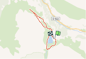

Length
7.9 km

Max alt
1786 m

Uphill gradient
241 m
Km-Effort
11.1 km

Min alt
1658 m

Downhill gradient
242 m
Boucle
Yes
Creation date :
2019-07-05 07:43:00.73
Updated on :
2019-07-05 17:39:08.909
4h49
Difficulty : Very easy

FREE GPS app for hiking
 SityTrail
IGN / Geographical institutes
SityTrail Plus
The world is yours!
About
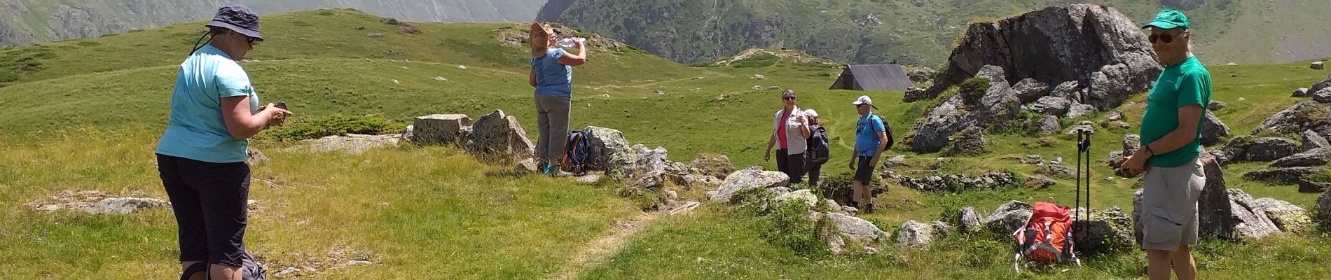
Trail Walking of 7.9 km to be discovered at Occitania, Hautespyrenees, Gavarnie-Gèdre. This trail is proposed by LouisROGER.
Photos


Positioning
Country:
France
Region :
Occitania
Department/Province :
Hautespyrenees
Municipality :
Gavarnie-Gèdre
Location:
Gèdre
Start:(Dec)
Start:(UTM)
258766 ; 4737421 (31T) N.
Comments