


lago lagacio

xav34830
User
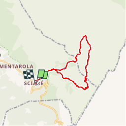

Length
14.9 km

Max alt
2528 m

Uphill gradient
951 m
Km-Effort
28 km

Min alt
1661 m

Downhill gradient
950 m
Boucle
Yes
Creation date :
2019-07-07 07:32:28.852
Updated on :
2019-07-07 13:52:15.099
6h18
Difficulty : Medium

FREE GPS app for hiking
 SityTrail
IGN / Geographical institutes
SityTrail Plus
The world is yours!
About
Trail Walking of 14.9 km to be discovered at Trentino-Alto Adige/Südtirol, South Tyrol, Badia - Abtei. This trail is proposed by xav34830.
Positioning
Country:
Italy
Region :
Trentino-Alto Adige/Südtirol
Department/Province :
South Tyrol
Municipality :
Badia - Abtei
Location:
Unknown
Start:(Dec)
Start:(UTM)
727717 ; 5159711 (32T) N.
Comments