


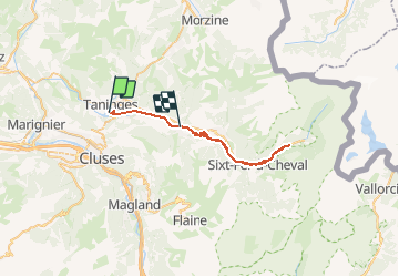
VTT(74)- Taninges - Verchaix - Sixt - Fer à Cheval

HG74250
User

Length
36 km

Max alt
867 m

Uphill gradient
552 m
Km-Effort
43 km

Min alt
622 m

Downhill gradient
505 m
Boucle
No
Creation date :
2019-07-07 18:54:39.88
Updated on :
2020-01-04 17:10:48.184
2h50
Difficulty : Very difficult

FREE GPS app for hiking
 SityTrail
IGN / Geographical institutes
SityTrail Plus
The world is yours!
About
Trail Mountain bike of 36 km to be discovered at Auvergne-Rhône-Alpes, Upper Savoy, Taninges. This trail is proposed by HG74250.
Description
Dimanche 7 Juillet 2019 - Seul.
Hier tour de 35 km Tour du Vouan
Positioning
Country:
France
Region :
Auvergne-Rhône-Alpes
Department/Province :
Upper Savoy
Municipality :
Taninges
Location:
Unknown
Start:(Dec)
Start:(UTM)
313754 ; 5107944 (32T) N.
Comments