


Hospice

kephas
User
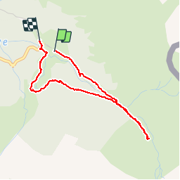

Length
3.7 km

Max alt
1547 m

Uphill gradient
160 m
Km-Effort
5.9 km

Min alt
1376 m

Downhill gradient
172 m
Boucle
Yes
Creation date :
2019-07-08 07:40:11.831
Updated on :
2019-07-08 09:14:13.776
1h33
Difficulty : Very easy

FREE GPS app for hiking
 SityTrail
IGN / Geographical institutes
SityTrail Plus
The world is yours!
About
Trail Walking of 3.7 km to be discovered at Occitania, Haute-Garonne, Bagnères-de-Luchon. This trail is proposed by kephas.
Positioning
Country:
France
Region :
Occitania
Department/Province :
Haute-Garonne
Municipality :
Bagnères-de-Luchon
Location:
Unknown
Start:(Dec)
Start:(UTM)
308027 ; 4732451 (31T) N.
Comments