


cham du cros

narberd
User
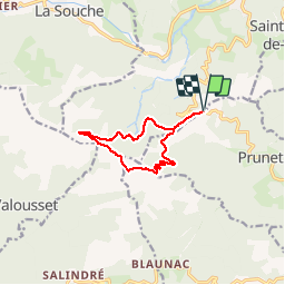

Length
10.4 km

Max alt
1201 m

Uphill gradient
489 m
Km-Effort
16.9 km

Min alt
773 m

Downhill gradient
488 m
Boucle
Yes
Creation date :
2018-09-01 21:11:37.896
Updated on :
2018-09-01 21:11:37.945
3h37
Difficulty : Medium

FREE GPS app for hiking
 SityTrail
IGN / Geographical institutes
SityTrail Plus
The world is yours!
About
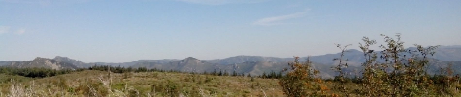
Trail Running of 10.4 km to be discovered at Auvergne-Rhône-Alpes, Ardèche, Jaujac. This trail is proposed by narberd.
Description
la cham du cros depuis la croix de millet. Départ par la piste de la croix de bauzon jusqu'au col du merle. Retour par une nouvelle piste sur le versant est.
Photos


Positioning
Country:
France
Region :
Auvergne-Rhône-Alpes
Department/Province :
Ardèche
Municipality :
Jaujac
Location:
Unknown
Start:(Dec)
Start:(UTM)
598579 ; 4940048 (31T) N.
Comments