


Tour de Landevennec 10-07-2019

jmrobin
User
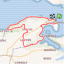

Length
17.6 km

Max alt
112 m

Uphill gradient
441 m
Km-Effort
23 km

Min alt
0 m

Downhill gradient
438 m
Boucle
Yes
Creation date :
2019-07-10 10:55:09.728
Updated on :
2019-07-10 15:01:27.067
4h05
Difficulty : Medium

FREE GPS app for hiking
 SityTrail
IGN / Geographical institutes
SityTrail Plus
The world is yours!
About
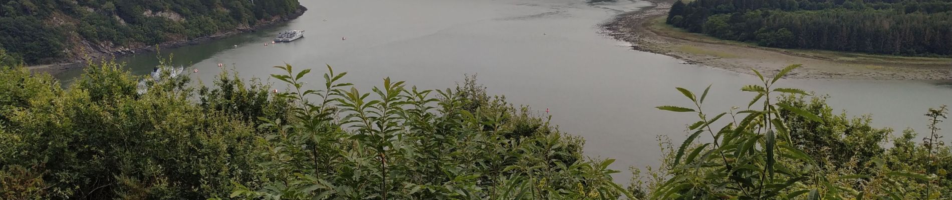
Trail Walking of 17.6 km to be discovered at Brittany, Finistère, Landévennec. This trail is proposed by jmrobin.
Photos

Positioning
Country:
France
Region :
Brittany
Department/Province :
Finistère
Municipality :
Landévennec
Location:
Unknown
Start:(Dec)
Start:(UTM)
405948 ; 5349648 (30U) N.
Comments