


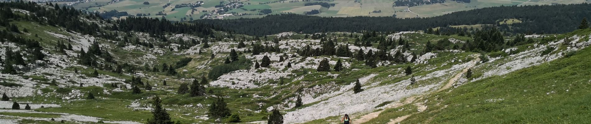
Pic Saint-Michel et col d'Arc Vercors

nathr
User
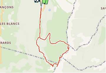

Length
9.2 km

Max alt
1965 m

Uphill gradient
649 m
Km-Effort
17.9 km

Min alt
1286 m

Downhill gradient
658 m
Boucle
Yes
Creation date :
2019-07-11 08:24:43.398
Updated on :
2019-07-11 11:47:21.368
3h03
Difficulty : Difficult

FREE GPS app for hiking
 SityTrail
IGN / Geographical institutes
SityTrail Plus
The world is yours!
About
Trail Walking of 9.2 km to be discovered at Auvergne-Rhône-Alpes, Isère, Lans-en-Vercors. This trail is proposed by nathr.
Photos


Positioning
Country:
France
Region :
Auvergne-Rhône-Alpes
Department/Province :
Isère
Municipality :
Lans-en-Vercors
Location:
Unknown
Start:(Dec)
Start:(UTM)
704814 ; 4998103 (31T) N.
Comments