


Navacelles

ARVIEU
User

Length
101 km

Max alt
714 m

Uphill gradient
2126 m
Km-Effort
129 km

Min alt
42 m

Downhill gradient
2122 m
Boucle
Yes
Creation date :
2019-07-13 07:00:49.509
Updated on :
2019-07-13 07:02:07.701
--
Difficulty : Difficult

FREE GPS app for hiking
 SityTrail
IGN / Geographical institutes
SityTrail Plus
The world is yours!
About
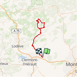
Trail Cycle of 101 km to be discovered at Occitania, Hérault, Gignac. This trail is proposed by ARVIEU.
Positioning
Country:
France
Region :
Occitania
Department/Province :
Hérault
Municipality :
Gignac
Location:
Unknown
Start:(Dec)
Start:(UTM)
544444 ; 4833754 (31T) N.
Comments