


2019 07 11 col de Portes

Ardeiserois
User

Length
108 km

Max alt
1017 m

Uphill gradient
1757 m
Km-Effort
132 km

Min alt
200 m

Downhill gradient
1757 m
Boucle
Yes
Creation date :
2019-07-13 09:10:33.852
Updated on :
2019-07-13 09:44:30.709
5h14
Difficulty : Difficult

FREE GPS app for hiking
 SityTrail
IGN / Geographical institutes
SityTrail Plus
The world is yours!
About
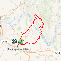
Trail Road bike of 108 km to be discovered at Auvergne-Rhône-Alpes, Isère, Bourgoin-Jallieu. This trail is proposed by Ardeiserois.
Positioning
Country:
France
Region :
Auvergne-Rhône-Alpes
Department/Province :
Isère
Municipality :
Bourgoin-Jallieu
Location:
Unknown
Start:(Dec)
Start:(UTM)
677187 ; 5052876 (31T) N.
Comments