


Pont de la Serre - Lacs de Lignin

soca
User
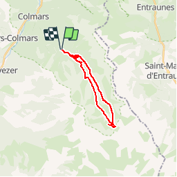

Length
18.5 km

Max alt
2290 m

Uphill gradient
736 m
Km-Effort
28 km

Min alt
1641 m

Downhill gradient
733 m
Boucle
Yes
Creation date :
2019-07-13 13:19:12.1
Updated on :
2019-07-13 13:20:08.68
5h52
Difficulty : Very difficult

FREE GPS app for hiking
 SityTrail
IGN / Geographical institutes
SityTrail Plus
The world is yours!
About
Trail Walking of 18.5 km to be discovered at Provence-Alpes-Côte d'Azur, Alpes-de-Haute-Provence, Colmars. This trail is proposed by soca.
Positioning
Country:
France
Region :
Provence-Alpes-Côte d'Azur
Department/Province :
Alpes-de-Haute-Provence
Municipality :
Colmars
Location:
Unknown
Start:(Dec)
Start:(UTM)
312519 ; 4892024 (32T) N.
Comments