


Ceyrat_2_Villages

jagarnier
User GUIDE
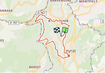

Length
8.6 km

Max alt
720 m

Uphill gradient
275 m
Km-Effort
12.2 km

Min alt
542 m

Downhill gradient
275 m
Boucle
Yes
Creation date :
2019-07-14 04:37:47.831
Updated on :
2023-02-08 16:10:18.925
2h30
Difficulty : Medium

FREE GPS app for hiking
 SityTrail
IGN / Geographical institutes
SityTrail Plus
The world is yours!
About
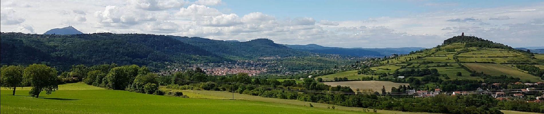
Trail Walking of 8.6 km to be discovered at Auvergne-Rhône-Alpes, Puy-de-Dôme, Ceyrat. This trail is proposed by jagarnier.
Description
Cette randonnée permet de découvrir les deux villages. D’abord Boisséjour, puis Ceyrat, par une allée forestière à flanc de montagne.
Photos

Positioning
Country:
France
Region :
Auvergne-Rhône-Alpes
Department/Province :
Puy-de-Dôme
Municipality :
Ceyrat
Location:
Unknown
Start:(Dec)
Start:(UTM)
504814 ; 5065006 (31T) N.
Comments
