


Marcko 18km

legereric
User
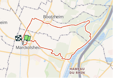

Length
17.7 km

Max alt
185 m

Uphill gradient
117 m
Km-Effort
19.2 km

Min alt
168 m

Downhill gradient
117 m
Boucle
Yes
Creation date :
2014-12-10 00:00:00.0
Updated on :
2014-12-10 00:00:00.0
4h13
Difficulty : Medium

FREE GPS app for hiking
 SityTrail
IGN / Geographical institutes
SityTrail Plus
The world is yours!
About
Trail Walking of 17.7 km to be discovered at Grand Est, Bas-Rhin, Marckolsheim. This trail is proposed by legereric.
Positioning
Country:
France
Region :
Grand Est
Department/Province :
Bas-Rhin
Municipality :
Marckolsheim
Location:
Unknown
Start:(Dec)
Start:(UTM)
391293 ; 5335918 (32U) N.
Comments
Difficile de suivre la trace du circuit dans la forêt. Nous avons cheminé par des pistes forestières soit en parallèle ou en direction de. Rando d'orientation et bucolique.