


vert la forme : tour de Villers au tour

maleclere
User

Length
20 km

Max alt
301 m

Uphill gradient
322 m
Km-Effort
25 km

Min alt
119 m

Downhill gradient
411 m
Boucle
No
Creation date :
2019-05-10 18:06:21.601
Updated on :
2019-07-16 10:52:16.024
2h48
Difficulty : Medium

FREE GPS app for hiking
 SityTrail
IGN / Geographical institutes
SityTrail Plus
The world is yours!
About
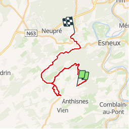
Trail Walking of 20 km to be discovered at Wallonia, Liège, Anthisnes. This trail is proposed by maleclere.
Description
A corriger
Positioning
Country:
Belgium
Region :
Wallonia
Department/Province :
Liège
Municipality :
Anthisnes
Location:
Anthisnes
Start:(Dec)
Start:(UTM)
679112 ; 5596677 (31U) N.
Comments