


Coix de millet

narberd
User

Length
46 km

Max alt
866 m

Uphill gradient
1258 m
Km-Effort
63 km

Min alt
201 m

Downhill gradient
1251 m
Boucle
Yes
Creation date :
2018-09-01 21:11:37.25
Updated on :
2018-09-01 21:11:37.269
4h02
Difficulty : Difficult

FREE GPS app for hiking
 SityTrail
IGN / Geographical institutes
SityTrail Plus
The world is yours!
About
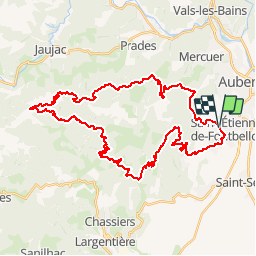
Trail Mountain bike of 46 km to be discovered at Auvergne-Rhône-Alpes, Ardèche, Saint-Étienne-de-Fontbellon. This trail is proposed by narberd.
Description
Circuit dans l'arrière pays d'aubenas. Départ par la route pour s'échauffer. Un peu de marche, beaucoup de chemin roulant, éviter les grosses chaleur
Positioning
Country:
France
Region :
Auvergne-Rhône-Alpes
Department/Province :
Ardèche
Municipality :
Saint-Étienne-de-Fontbellon
Location:
Unknown
Start:(Dec)
Start:(UTM)
608901 ; 4939201 (31T) N.
Comments