


Nointel 21_07

maxEA65
User
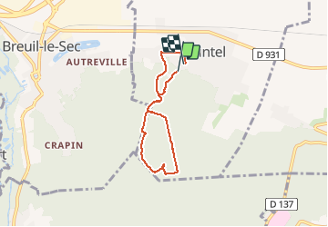

Length
4.8 km

Max alt
167 m

Uphill gradient
104 m
Km-Effort
6.3 km

Min alt
57 m

Downhill gradient
123 m
Boucle
Yes
Creation date :
2019-07-21 08:36:31.201
Updated on :
2019-07-21 09:28:47.441
51m
Difficulty : Very easy

FREE GPS app for hiking
 SityTrail
IGN / Geographical institutes
SityTrail Plus
The world is yours!
About
Trail Walking of 4.8 km to be discovered at Hauts-de-France, Oise, Nointel. This trail is proposed by maxEA65.
Positioning
Country:
France
Region :
Hauts-de-France
Department/Province :
Oise
Municipality :
Nointel
Location:
Unknown
Start:(Dec)
Start:(UTM)
462052 ; 5469015 (31U) N.
Comments